esri Malaysia organized a user group conference on 18-19th Nov 2016. It was a nice gathering and I was there for the first time. Here are my notes/observations and takeaways about the event. This might be useful for my friends and professionals in GIS and petroleum domain.
- Smart Maps rising, that’s enables and motivate people to work together smartly and its needs commonly thinking people and such collaboration promotes this.
- Cloud rising: 7 billion map request/month and delivered 1 million maps/day
- MaCGDI won SAG award in 2016 however the overall delivery was not explained well in presentation.
- Interesting aspect of GIS discussed that put content in context.
- Esri is discussing GIS into three systems:
- System of record (data storage and management)
- System of engagement (collaboration, server based, feedback mechanism)
- System of insight (analysis, analytics, visualizations)
- Insight for ArcGIS: An extension coming with 10.5 version that has similar capabilities like spotfire (TIBCO)
- It will provide spatial, attribute and temporal analysis at the same time
- GeoAnalytics is coming to utilize the big data efficiently.
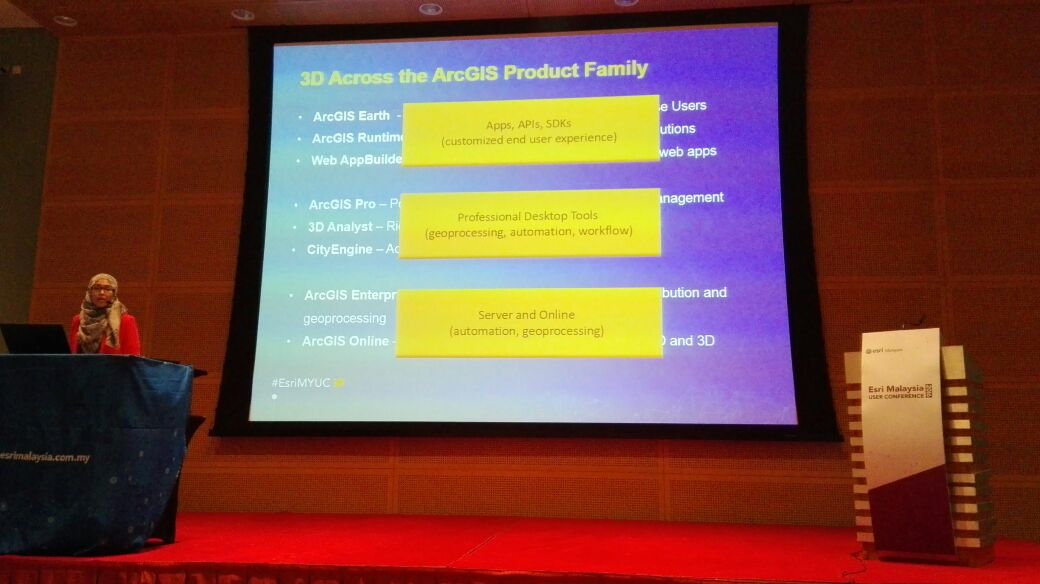
- Esri tried to demonstrate the workflows of 3D but that was not linked to any concrete business problem solution. Just the capabilities of esri to handle 3D.
- ArcGIS Pro has capabilities to navigate to sub surface data, which is interesting for Geoscience domain, I would experiment with it very soon.
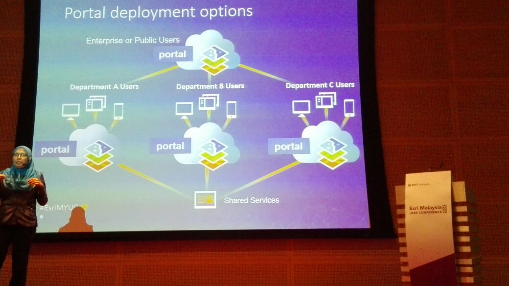
- Portal for ArcGIS: See orientation and demo of setting up. This I already have done a couple times in my R&D but a few tips were shared.
- You can download any template you like from ArcGIS Online and reconfigure and use that in your Portal. The portal use PowerPoint template slides and a bunch of picture.
- There is not difference between the functionalities and capabilities between ArcGIS online and Portal for ArcGIS from user’s end point. Esri is responsible to support, maintain and scale the ArcGIS online were as for Portal the company need to maintain themselves.
- New updates, bug fixes are also role out on ArcGIS online first and later made available for Portal users.
- Model Builder: Only 2/3 users were in about 100 who has worked in Model builder therefore there was not much new. The basic was discussed however I got a chance to talk to another esri expert at ArcLab both. I was wondering, if its possible to build a model and share with your team to just use no rights to make change to it or even no rights to see inside it. Seems that GPK (Geoprocessing package) has capability to do so. This is again something to exercise in coming days.
- AcGIS Server Configuration/Performance: A couple of presentations by Firdaus Asri were really high value for me. It was all about troubleshooting and best practices for better performance. A few takeaways were:
- Three primary areas that effects performance are data access, rendering and image compression.
- Using, rebuilding and compressing the spatial index could help in first bottle neck.
- Publishing analyser is nice addition. I do agree and I was waiting for this kind of tool.
- More layers in your mxd effects the performance.
- Use’ check and repair data connections feature.
- VM has estimated performance plenty of about 30% as compare to physical machines so take that in consideration in VM based data centres.
- SAN is good option for server and SSD is for desktop.
- Check out and learn about Max. heap side in ArcGIS Server Manager.
- Web adopter in IIS: checkout the max worker processes
- A few tools that could help you manager and troubleshooting multiple servers are:
- Telerik Fiddler Web Debugger
- Nagios – Server Monitoring Dashboard
- ESRI System Monitor (its free)
- mxdperfstat
- ArcGIS deployment strategies: Explained by Azlins Mahad. I was motivated to have one-on-one talk with her but the conference schedule was very tight to do so. However, some of the takeaways from her presentation were:
- Esri moving towards multiple portal and this will open some new business scenarios.
- Need to know the recycle time she talked about.
- Query layer is a good way for publishing scenarios.
- Should maintain transactional server and push data to publishing server later on.
- GIS experts should partner with IT for better.
- Both should honour the SEM (subject matter experts) as they are the ultimate users.
- Esri Malaysia has training for system design and people can certify after sitting in exam.
- Programming: WAB and application builder are very easy to use. Qt is there and some capabilities you can program using python. Unfortunately, I missed the development session to attend about drone us in GIS but there is not much about that to write.


